“Do unto those downstream, as you would have those upstream do unto you.” – Wendell Berry
What is a watershed?
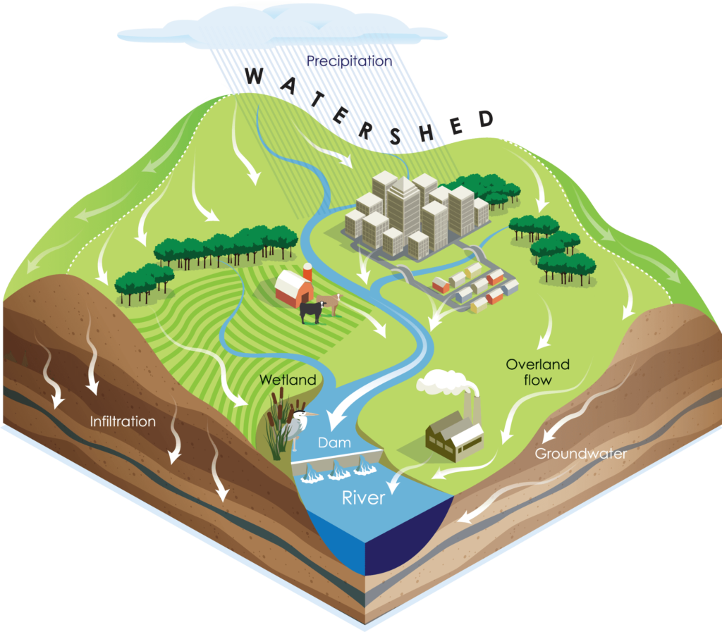
A watershed is an area of land that channels precipitation and runoff to a common outlet, such as a stream, river, lake or wetland. As rainwater and melting snow run downhill, they carry sediment and other materials into our streams, lakes, wetlands, and groundwater. Everyone’s land management practices within a watershed affect how rainfall runoff, pollutants and sediment move down hill and downstream. We all live in a watershed and contribute to the volume and quality of stormwater runoff!
Check out this interactive website to watch how water moves through watersheds: river-runner.samlearner.com/go
Scott County Watersheds
This map of Scott County reveals the major watersheds that make up the county. Can you find your watershed?
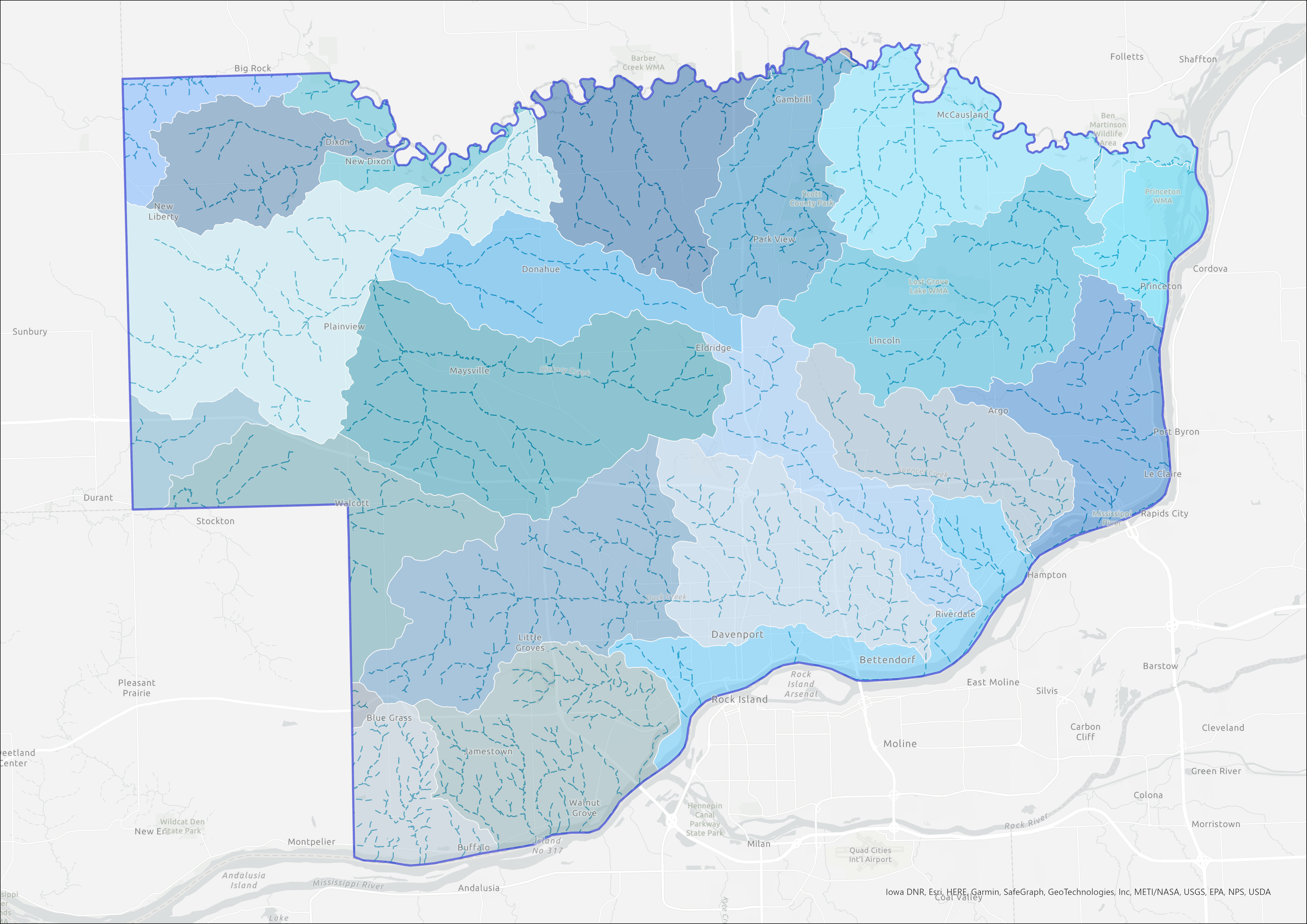
You can view interactive maps of Scott County’s watersheds here, or visit the DNR Mapping page to find the Watershed Atlas, Natural Areas Inventory and more!
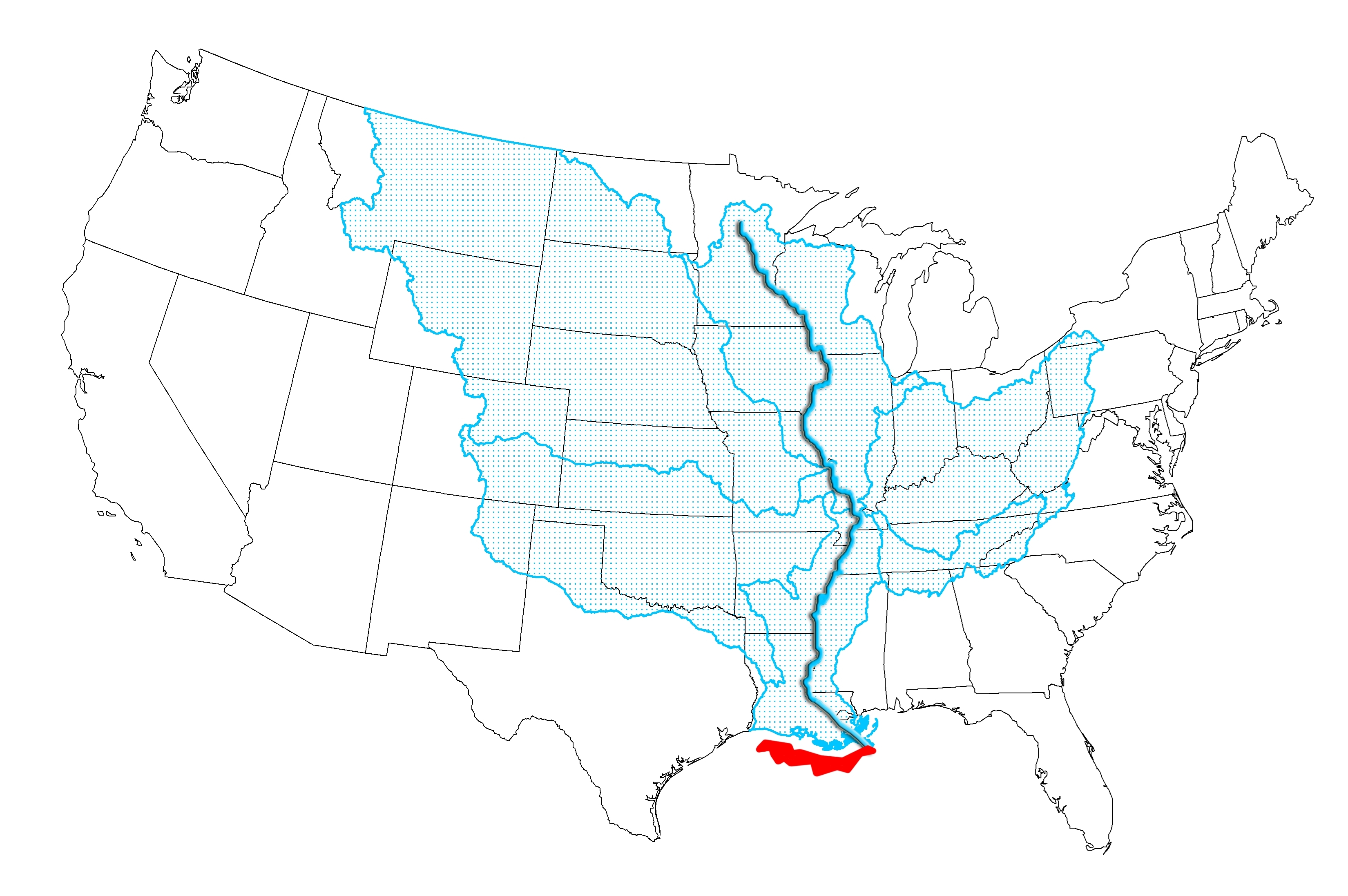
Mississippi River Watershed
Small watersheds (like those in Scott County) are part of larger watersheds. Everyone who resides in Scott County is in the Mississippi River Watershed. The blue area on the map below is the Mississippi River Watershed. The red area is the “Dead Zone” in the Gulf of Mexico, where excess nutrients deplete the oxygen required to sustain most aquatic wildlife.