HUC (pronounced “huck”) is an acronym that stands for Hydrologic Unit Codes, and is often present in discussions about watersheds and water quality.
What does that mean?
Hydrologic Unit Codes are used nationwide to differentiate drainage areas with a series of numbers, similar to a zip code. “HUC” is often followed by a number (e.g., HUC 2). The number after “HUC” refers to the size of the watershed and the number of digits that are associated with its code. The larger the number, the smaller the watershed. Click here to learn more about watersheds.
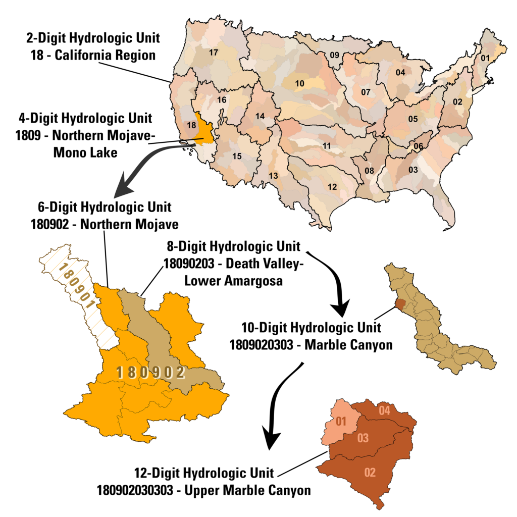
HUCs are hierarchical and divide the country into 21 regions (HUC 2), 222 subregions (HUC 4), 370 basins (HUC 6), 2,270 subbasins (HUC 8), ~20,000 watersheds (HUC 10), and roughly 100,000 subwatersheds (HUC 12). The division criteria for HUCs are defined in the National Watershed Boundary Dataset.
| Division | Level | # of Digits in Hydrologic Unit Code | Average Size |
| Region | HUC 2 | 2 (e.g., 07) | 177,560 square miles |
| Subregion | HUC 4 | 4 (e.g., 0708) | 16,800 square miles |
| Basin | HUC 6 | 6 (e.g., 070801) | 10,596 square miles |
| Subbasin | HUC 8 | 8 (e.g., 07080101) | 700 square miles |
| Watershed | HUC 10 | 10 (e.g., 0708010103) | 227 square miles |
| Subwatershed | HUC 12 | 12 (e.g., 070801010302) | 40 square miles |
This hierarchy can be visualized using the image below:

To put this in perspective for our community…
| Division | Level | HUC | HUC Name |
| Region | HUC 2 | 07 | Upper Mississippi Region |
| Subregion | HUC 4 | 0708 | Upper Mississippi-Iowa-Skunk-Wapsipinicon |
| Basin | HUC 6 | 070801 | Upper Mississippi-Skunk-Wapsipinicon |
| Subbasin | HUC 8 | 07080101 | Copperas-Duck |
| Watershed | HUC 10 | 0708010103 | Duck Creek |
| Subwatershed | HUC 12 | 070801010302 | Lower Duck Creek |
HUCs may be conversationally referred to by their number, such as, “We are focusing our efforts on the HUC 8s in Iowa.” They can also be referred to by name, as in, “We sampled three sites in the Lower Duck Creek Watershed.” Typically in formal documents, however, you will find the code listed to clarify what watershed is referenced.
HUC 12s
Watersheds are commonly managed at the HUC 12 level. This is because these subwatersheds are the smallest level of delineation in the National Watershed Boundary Dataset and allow watershed management and conservation professionals effectively focus improvement efforts.
HUC 12s in Scott County
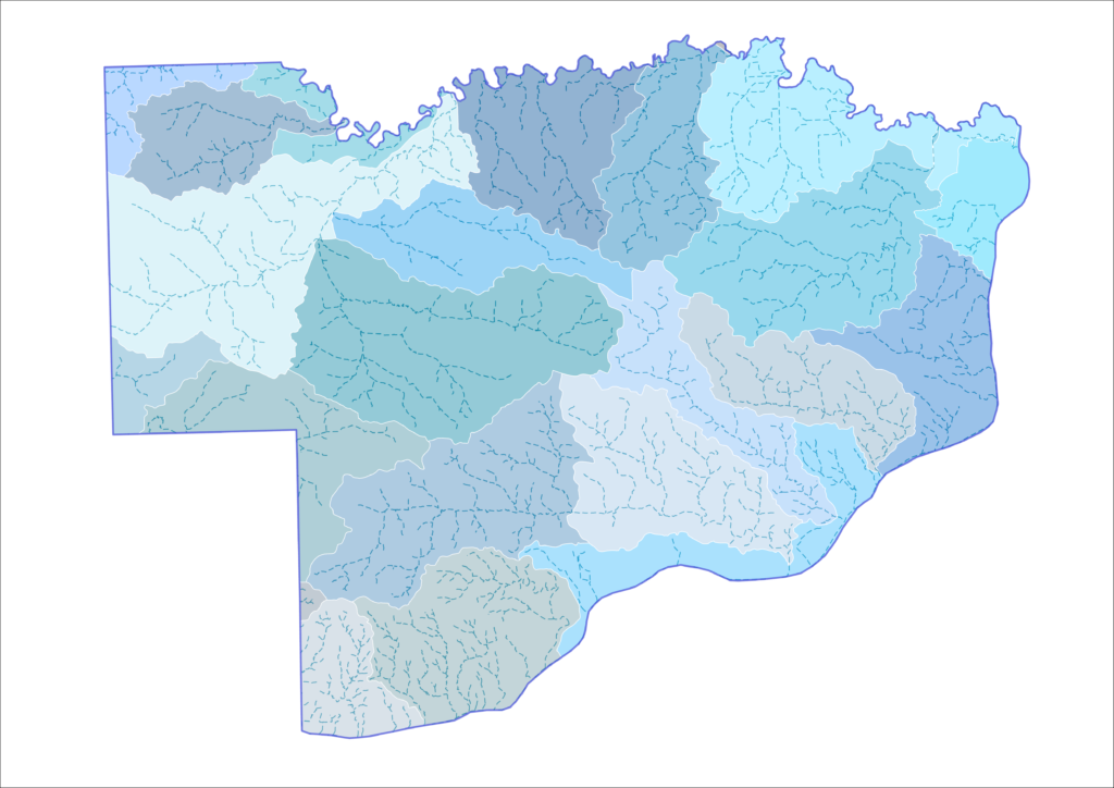
There are 22 HUC 12 subwatersheds in Scott County. Click the image below to visit an interactive map where you can find what HUC 12 you live in!

In sum, a Hydrologic Unit Code, or HUC, is like a zip code for a drainage area. The HUC system is used nationwide to divide and differentiate watersheds of varying sizes. HUC 12s are often the focus when working to effect change and improvements in water quality.